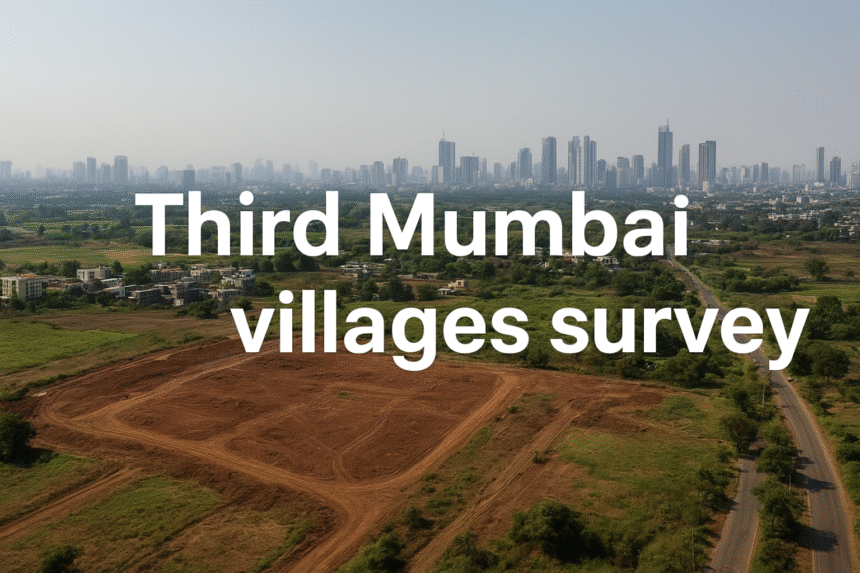
Third Mumbai 124 villages survey has begun — state agencies are carrying out large-scale aerial and ground mapping across 124 villages in the proposed Karnala–Sai–Chirner (KSC) New Town area as part of the Mumbai 3.0 masterplan. This survey is the foundational step in converting a wide swathe of Raigad and adjacent zones into a planned, connected, investment-ready urban region. In this post we unpack what the survey covers, why it matters for landowners and investors, the practical timeline and risks, and how to act now.
- What the Third Mumbai 124 villages survey covers
- Why the Third Mumbai 124 villages survey is a game-changer
- 9 Transformative insights from the survey (what to watch)
- How the Third Mumbai 124 villages survey affects landowners & investors
- Timeline & next steps (what officials will likely publish)
- Risks, safeguards & legal checks
- Practical checklist for buyers (quick actions)
- Where to follow official updates
- Conclusion & CTA
What the Third Mumbai 124 villages survey covers
The Third Mumbai 124 villages survey combines high-resolution aerial imagery, LiDAR mapping, cadastral (title) checks and ground-level topographical studies. With this data authorities aim to:
- Precisely map parcel boundaries and ownership records.
- Identify eco-sensitive areas, water bodies, and flood-prone zones.
- Assess soil, slope and drainage conditions for infrastructure planning.
- Propose zoning for residential, commercial, industrial and green spaces.
This dataset allows planners (CIDCO and other agencies) to draw up Town Planning Schemes (TPS) with much higher accuracy than earlier ad-hoc methods — which means smarter infrastructure placement and fewer surprises during execution. Early reports about these surveys are available from construction and planning portals. (See Construction World and related reporting for source details.)
Why the Third Mumbai 124 villages survey is a game-changer
There are three practical reasons this survey matters:
- Clarity on titles & land status. The survey helps reduce disputes by documenting current ownership and encumbrances — vital if land pooling or acquisition is proposed.
- Better planning, less sprawl. With mapped eco-zones and utilities, authorities can design signal-free corridors, transit hubs, and green belts — avoiding the unstructured growth Mumbai experienced historically.
- Investor confidence. Precise datasets reduce uncertainty for developers and financiers, enabling faster approvals and more predictable timelines — a major reason institutional investment follows such surveys.
Put simply: the Third Mumbai 124 villages survey turns an aspirational plan into an actionable map for development.
9 Transformative insights from the survey (what to watch)
- Zoning clarity will emerge early. Expect published TPS maps showing which pockets become residential, industrial, or institutional.
- Land-pooling models likely. Authorities often prefer pooling arrangements to consolidate parcels for large-scale projects.
- Priority corridors visible. The survey will reveal which stretches will get first-phase roads, utilities and transit links.
- Conservation constraints defined. Identified green/wetland areas will be protected, guiding where development is permissible.
- Utility hubs planned near transport nodes. Power, water and fiber planning around future stations will be prioritized.
- Education & research precincts possible. With talk of universities and innovation hubs, some zones may be earmarked for institutional use.
- Phased land acquisition timelines. The survey enables realistic phasing, helping investors plan entry timing.
- Improved valuation models. Data-driven appraisal replaces guesswork; early land value signals will be more reliable.
- Greater public–private collaboration. With clear maps, PPP bids and developer participation become more structured.
Each of these outcomes flows directly from the core work of the Third Mumbai 124 villages survey — and together they create a roadmap for long-term, sustainable urbanization.
How the Third Mumbai 124 villages survey affects landowners & investors
If you own or plan to buy land in the KSC belt, here’s what changes:
- Short-term: Expect notices, stakeholder consultations, and possible sampling or verification visits. Do not act on rumors — rely on official TPS maps once published.
- Medium-term: Zoning designations and infrastructure timelines will drive value shifts. Parcels near first-phase corridors will lead the market.
- Long-term: Properly zoned, serviced land will see durable appreciation as Mumbai 3.0 moves from plan to construction.
Investors should remember the survey reduces information asymmetry — but it does not guarantee immediate price jumps. Real gains come after zoning, approvals, and infrastructure delivery.
Timeline & next steps (what officials will likely publish)
Based on similar TPS processes elsewhere, expect this cadence after the survey:
- Raw data analysis & stakeholder notifications (weeks–months).
- Draft TPS maps & public consultation (2–4 months).
- Final TPS notification, compensation/land pooling rules (4–8 months).
- Tendering and infrastructure work (12+ months onward for phase 1).
Remember: timelines can vary because of local consent, environmental clearances, and final budget allocations — so treat these as directional.
Risks, safeguards & legal checks
- Title clarity: Use a qualified advocate to verify chain of title before any purchase.
- Compensation disputes: If land pooling is proposed, study the benefit share model carefully.
- Environmental red flags: Parcels in eco-sensitive zones may face development restrictions.
- Speculation risk: Avoid high-leverage speculative buys until TPS notifications are official.
Practical checklist for buyers (quick actions)
- Subscribe to official CIDCO / state tender alerts.
- Request GIS extracts or ask for parcel-level data when TPS drafts are published.
- Engage a local lawyer to pre-check title & encumbrances.
- Visit parcels at different times to verify access and on-ground conditions.
- Consider staged investments: a small parcel now + another after TPS clarity.
Where to follow official updates
- ConstructionWorld coverage on Mumbai 3.0 and related planning updates.
- Local planning portals and CIDCO / MMRDA tender pages for TPS notices.
- Reputable industry analyses (planning & real estate research websites) that summarize technical reports.
Conclusion & CTA
The Third Mumbai 124 villages survey is the critical first step turning Mumbai 3.0 from an idea into mapped reality. For landowners and investors, this is the phase to get informed, verify legal status, and prepare for a disciplined, data-driven investment approach.
📩 Want expert help mapping opportunities and verifying titles in Third Mumbai? Contact Cinetric Realty / Tisari Mumbai for vetted plots, legal checks and tailored acquisition plans.